|
Issued: 1010 Sunday 15 October 2017
Duty forecaster: John Ejdowski
Gales, heavy rain at times
Much of this week is looking unsettled and windy. Monday Ex-Hurricane Ophelia affects Britain with strong gales developing in the west. Strongest winds will run up through the Irish Sea affecting Northern Ireland and western coasts of gusts of 70-80 mph. The strong winds transfer into northern England and Scotland in the evening and night. Above normal temperatures are expected but near normal in the north.
For the weather for the next few days click here
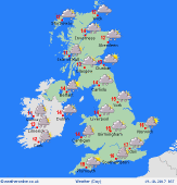
Wednesday 18/10/17
Breezy and unsettled on Wednesday with sporadic outbreaks of rain. This may be heaviest across the south east of England in the afternoon. Most of Britain sees spells of rain into the evening and night. Expect highs of 12 to 16C.
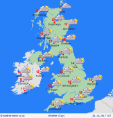
 Thursday 19/10/17 Thursday 19/10/17
Today temperatures will be near to above normal but chilly across the north. Windy across England and Wales with heavy spells of rain - drier to the north. Rain may linger across central and eastern England through the night. Expect highs of 12 to 16C.
 Friday 20/10/17 Friday 20/10/17
Generally cool but temperatures remain above normal across the south. A drier, brighter day to come with just a few widely scattered showers. Quite windy as another area of heavy rain may spread into most places in the evening and night. Look for highs of 11 to 16C.
 Saturday 21/10/17 Saturday 21/10/17
Windy with showers across England and Wales, some heavy, interspersed with dry, sunnier spells. Gales may affect the channel coasts. Largely dry across Scotland. Rain may affect England and Wales overnight while dry across Scotland and Northern England. Expect highs of 11 to 16C.
Sunday 22/10/17
Temperatures appear near normal but feeling chilly in brisk north west winds. Most places should be dry with variable cloud and sunnier spells. Just a few showers in the west. More rain may sweep into Britain in the night. Expect highs of 11 to 15C.
Monday 23/10/17
Quite windy and unsettled today. A front is expected to spread and area of moderate to heavy west to east during the day. This clears to blustery showers from the west. Look for highs of 12 to 17C.
|
