|
Issued: 0945hrs Monday 14th September 2026
Duty forecaster: Alexi Venerus
Staying mixed and tunring cooler for a time before higher pressure builds from the weekend.
Staying mixed through this week and with a generally westerly flow most of the rain will affect the north and west, drier further south and east. Windy for all at times. From the weekend and into next week pressure attempts to rise bringing the chance for milder and more settled weather.
For the weather for the next few days click here
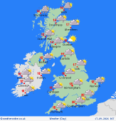 Thursday 17/9/26 Thursday 17/9/26
Low pressure to the north pushes a band of patchy rain southeast through Wales and England in the morning. Becoming windy in Ireland and Scotland with showers streaming in from the west, spreading into northwest England and Wales with time. Central and south England will brighten up, but also feel a fresh wind. Highs at 14 to 20C.
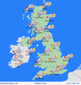 Friday 18/9/26 Friday 18/9/26
Westerly flow continues on Friday with frequent showers in the west and northwest, staying largely dry further east. There is a risk for some patchy rain to push across Ireland and become possibly heavy for parts of Wales and southwest England later. Staying quite windy. Highs at 14 to 20C.
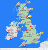 Saturday 19/9/26 Saturday 19/9/26
Pressure builds through Saturday though it stays windy across Scotland, northern England and Northern Ireland with frequent showers in the west, longer spells of rain across northwest Scotland. Drier elsewhere though some showers affecting southern English coasts. Highs at 13 to 21C.
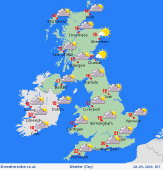 Sunday 20/9/26 Sunday 20/9/26
Most will stay dry and fine on Sunday though a dip in the pressure will bring spells of rain and gusty winds to Northern Ireland into west Scotland and northwest England later. Highs at 12C north Scotland, but nearer 17C south Scotland, to humid 20 to 23C in England and Ireland.
Monday 21/9/26
Patchy rain across Scotland into northern England on Monday but generally a fine day with developing sunny spells. Lighter winds too. Highs at 15C in Scotland to 23C south England.
Tuesday 22/9/26
Pressure remains high on Tuesday giving a largely dry and fine day with warm sunny spells expected as a southerly flow pulls in. Always more cloud and some rain affecting northwest Scotland. Highs at 14C in Scotland to 23C south England.
|


