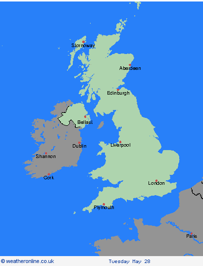
Weather Warnings Archive: Monday 27 May 2024 03:00 BST - UK


00:00-06:00

06:00-12:00

12:00-18:00

18:00-24:00


Severe Weather Warnings: Thunderstorms
issued by the Metoffice at
02:00, 27.05.2024
valid from
11:00, 27.05.2024
until
22:00, 27.05.2024
Region: Highland & Eilean Siar
Slow-moving showers and thunderstorms are expected to develop during Monday. Rainfall accumulations will vary significantly across the warning area but 10-20 mm in an hour is likely in places with a chance of up to 30-40 mm in a few hours. Lightning may also cause impacts. What should I do? Consider if your location is at risk of flash flooding. If so, consider preparing a flood plan and an emergency flood kit. Prepare to protect your property and people from injury. Before gusty winds arrive, check to ensure moveable objects or temporary structures are well secured. Items include; bins, garden furniture, trampolines, tents, gazebos, sheds, and fences. Give yourself the best chance of avoiding delays by checking road conditions if driving, or bus and train timetables, amending your travel plans if necessary. People cope better with power cuts when they have prepared for them in advance. It’s easy to do; consider gathering torches and batteries, a mobile phone power pack and other essential items. If you find yourself outside and hear thunder, protect yourself by finding a safe enclosed shelter (such as a car). Do not shelter under or near trees, or other structures which may be struck by lightning. If you are on an elevated area move to lower ground. Be prepared for weather warnings to change quickly: when a weather warning is issued, the Met Office recommends staying up to date with the weather forecast in your area.
Chief ForecasterSlow-moving heavy showers and thunderstorms may cause flooding and disruption in places.
The public is advised to take extra care, further information and advice can be found here: http://www.metoffice.gov.uk/weather/uk/links.html
Severe Weather Warnings: Rain
issued by the Metoffice at
02:00, 27.05.2024
valid from
00:00, 27.05.2024
until
09:00, 27.05.2024
Region: Highland & Eilean Siar
An area of heavy rain will become slow-moving over Skye and parts of the Outer Hebrides on Sunday night and into Monday morning. While accumulations are uncertain, 25-35 mm seems likely to fall quite widely within a 6 to 9 hour period, with perhaps as much as 40-50 mm in a few locations. What should I do? Check if your property could be at risk of flooding. If so, consider preparing a flood plan and an emergency flood kit. Give yourself the best chance of avoiding delays by checking road conditions if driving, amending your travel plans if necessary. Be prepared for weather warnings to change quickly: when a weather warning is issued, the Met Office recommends staying up to date with the weather forecast in your area.
Chief ForecasterHeavy rain bringing localised flooding and travel disruption.
The public is advised to take extra care, further information and advice can be found here: http://www.metoffice.gov.uk/weather/uk/links.html
Severe Weather Warnings: Thunderstorms
issued by the Metoffice at
02:00, 27.05.2024
valid from
11:00, 27.05.2024
until
22:00, 27.05.2024
Region: Grampian
Slow-moving showers and thunderstorms are expected to develop during Monday. Rainfall accumulations will vary significantly across the warning area but 10-20 mm in an hour is likely in places with a chance of up to 30-40 mm in a few hours. Lightning may also cause impacts. What should I do? Consider if your location is at risk of flash flooding. If so, consider preparing a flood plan and an emergency flood kit. Prepare to protect your property and people from injury. Before gusty winds arrive, check to ensure moveable objects or temporary structures are well secured. Items include; bins, garden furniture, trampolines, tents, gazebos, sheds, and fences. Give yourself the best chance of avoiding delays by checking road conditions if driving, or bus and train timetables, amending your travel plans if necessary. People cope better with power cuts when they have prepared for them in advance. It’s easy to do; consider gathering torches and batteries, a mobile phone power pack and other essential items. If you find yourself outside and hear thunder, protect yourself by finding a safe enclosed shelter (such as a car). Do not shelter under or near trees, or other structures which may be struck by lightning. If you are on an elevated area move to lower ground. Be prepared for weather warnings to change quickly: when a weather warning is issued, the Met Office recommends staying up to date with the weather forecast in your area.
Chief ForecasterSlow-moving heavy showers and thunderstorms may cause flooding and disruption in places.
The public is advised to take extra care, further information and advice can be found here: http://www.metoffice.gov.uk/weather/uk/links.html
Severe Weather Warnings: Thunderstorms
issued by the Metoffice at
02:00, 27.05.2024
valid from
11:00, 27.05.2024
until
22:00, 27.05.2024
Region: Central, Tayside & Fife
Slow-moving showers and thunderstorms are expected to develop during Monday. Rainfall accumulations will vary significantly across the warning area but 10-20 mm in an hour is likely in places with a chance of up to 30-40 mm in a few hours. Lightning may also cause impacts. What should I do? Consider if your location is at risk of flash flooding. If so, consider preparing a flood plan and an emergency flood kit. Prepare to protect your property and people from injury. Before gusty winds arrive, check to ensure moveable objects or temporary structures are well secured. Items include; bins, garden furniture, trampolines, tents, gazebos, sheds, and fences. Give yourself the best chance of avoiding delays by checking road conditions if driving, or bus and train timetables, amending your travel plans if necessary. People cope better with power cuts when they have prepared for them in advance. It’s easy to do; consider gathering torches and batteries, a mobile phone power pack and other essential items. If you find yourself outside and hear thunder, protect yourself by finding a safe enclosed shelter (such as a car). Do not shelter under or near trees, or other structures which may be struck by lightning. If you are on an elevated area move to lower ground. Be prepared for weather warnings to change quickly: when a weather warning is issued, the Met Office recommends staying up to date with the weather forecast in your area.
Chief ForecasterSlow-moving heavy showers and thunderstorms may cause flooding and disruption in places.
The public is advised to take extra care, further information and advice can be found here: http://www.metoffice.gov.uk/weather/uk/links.html
Severe Weather Warnings: Thunderstorms
issued by the Metoffice at
02:00, 27.05.2024
valid from
11:00, 27.05.2024
until
22:00, 27.05.2024
Region: SW Scotland, Lothian Borders
Slow-moving showers and thunderstorms are expected to develop during Monday. Rainfall accumulations will vary significantly across the warning area but 10-20 mm in an hour is likely in places with a chance of up to 30-40 mm in a few hours. Lightning may also cause impacts. What should I do? Consider if your location is at risk of flash flooding. If so, consider preparing a flood plan and an emergency flood kit. Prepare to protect your property and people from injury. Before gusty winds arrive, check to ensure moveable objects or temporary structures are well secured. Items include; bins, garden furniture, trampolines, tents, gazebos, sheds, and fences. Give yourself the best chance of avoiding delays by checking road conditions if driving, or bus and train timetables, amending your travel plans if necessary. People cope better with power cuts when they have prepared for them in advance. It’s easy to do; consider gathering torches and batteries, a mobile phone power pack and other essential items. If you find yourself outside and hear thunder, protect yourself by finding a safe enclosed shelter (such as a car). Do not shelter under or near trees, or other structures which may be struck by lightning. If you are on an elevated area move to lower ground. Be prepared for weather warnings to change quickly: when a weather warning is issued, the Met Office recommends staying up to date with the weather forecast in your area.
Chief ForecasterSlow-moving heavy showers and thunderstorms may cause flooding and disruption in places.
The public is advised to take extra care, further information and advice can be found here: http://www.metoffice.gov.uk/weather/uk/links.html
Severe Weather Warnings: Thunderstorms
issued by the Metoffice at
02:00, 27.05.2024
valid from
18:00, 26.05.2024
until
03:00, 27.05.2024
Region: Northern Ireland
A band of heavy rain with a few thunderstorms is making slow northward progress out of the Republic of Ireland, and is likely to continue north to bring spells of rain, heavy at times with a risk of thunder, to the south and west of Northern Ireland. 10-15 mm of rain could fall in less than a hour, with the risk of 25-35 mm in 2-3 hours in a few places. What should I do? Consider if your location is at risk of flash flooding. If so, consider preparing a flood plan and an emergency flood kit. Give yourself the best chance of avoiding delays by checking road conditions if driving, or bus and train timetables, amending your travel plans if necessary. People cope better with power cuts when they have prepared for them in advance. It’s easy to do; consider gathering torches and batteries, a mobile phone power pack and other essential items. If you find yourself outside and hear thunder, protect yourself by finding a safe enclosed shelter (such as a car). Do not shelter under or near trees, or other structures which may be struck by lightning. If you are on an elevated area move to lower ground. Be prepared for weather warnings to change quickly: when a weather warning is issued, the Met Office recommends staying up to date with the weather forecast in your area.
Chief ForecasterHeavy rain, with a risk of thunderstorms, may bring some disruption this evening and into Monday morning
The public is advised to take extra care, further information and advice can be found here: http://www.metoffice.gov.uk/weather/uk/links.html


27.05.2024