Weather Warnings Archive: Thursday 28 Mar 2024 22:55 GMT - UK


Severe Weather Warnings: Wind
issued by the Metoffice at
22:55, 28.03.2024
valid from
07:00, 28.03.2024
until
23:59, 28.03.2024
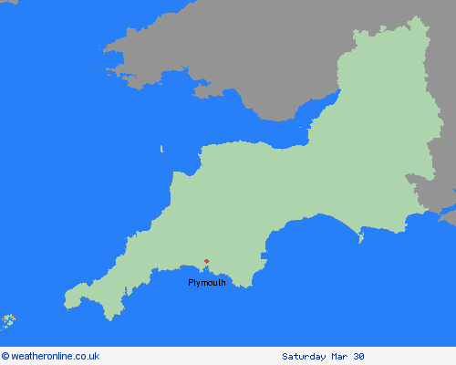
Region: South West England
A deep area of low pressure will bring a spell of very windy weather to parts of southwest England at first, before spreading further east during the day. Gusts of 50 mph are expected quite widely, while some exposed coastal spots may experience gusts of 60 to 70 mph, with large waves also likely. The strong winds will be accompanied by heavy, squally showers with the possibility of hail and thunder in some locations. Hail won't fall everywhere but where it does it can quickly make road surfaces slippery, while surface water and spray are likely to worsen travel conditions rather more widely. What should I do? Prepare to protect your property and people from injury. Check for loose items outside your home and plan how you could secure them. Items include bins, garden furniture, trampolines, tents, sheds and fences. Give yourself the best chance of avoiding delays by checking road conditions if driving, or bus and train timetables, amending your travel plans if necessary. People cope better with power cuts when they have prepared for them in advance. It’s easy to do, consider gathering torches and batteries, a mobile phone power pack and other essential items. If you are on the coast, stay safe during stormy weather by being aware of large waves. Even from the shore large breaking waves can sweep you off your feet and out to sea. Take care if walking near cliffs; know your route and keep dogs on a lead. In an emergency, call 999 and ask for the Coastguard. Be prepared for weather warnings to change quickly. When a weather warning is issued, the Met Office recommends staying up to date with the weather forecast in your area.
Chief ForecasterStrong winds may lead to hazardous conditions and bring some disruption.
The public is advised to take extra care, further information and advice can be found here: http://www.metoffice.gov.uk/weather/uk/links.html
28.03.2024


